Karur Taluk, which was once a part of Coimbatore district, was merged with Tiruchirappalli district during 1910. Karur District came into existence by the bifurcation of Trichy District . It is bounded on the North by Namakkal, South by Dindugal, East by Tiruchirappalli and West by Erode districts.
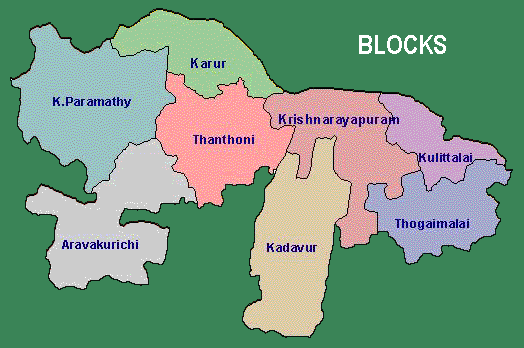
Karur District consists of two Revenue Divisions viz., Karur and Kulithalai, Seven Taluks viz., Karur, Aravakurichi, Manmangalam, Pugalur, Kulithalai, Krishnarayapuram and Kadavur, comprising of 203 Revenue Villages. The District has Eight blocks viz. Karur, Thanthoni, Aravakurichi, K.Paramathi, Kulithalai, Krishnarayapuram, Kadavur, and Thogamalai comprising of 157 Village Panchayats.
Karur District is located in central Tamil Nadu and is 410 K.M. away from Chennai. The District has an area of 2904 Sq.Km. It is an inland district without any coast line. The District has Amaravathi River and Cauvery River and it has no well marked natural divisions.
